STARLINK-1152
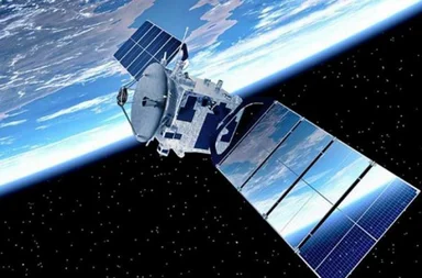
Willst du die Flugzeiten für die neueste Gruppe wirklich nicht überprüfen? Starlink G15-18?
Klicken Sie. hier, um die Abflugszeiten für die neueste Gruppe zu überprüfen.!
Die gesamte Gruppe kannst du auf unserer Seite verfolgen. Tracker Starlink G15-18.
Informationen über den Satelliten. STARLINK-1152 - STARLINK BE
| Name im Katalog Spacetrack | STARLINK-1152 |
| Alternative Bezeichnung | STARLINK BE |
| Gruppe | Starlink L3 |
| Folge STARLINK-1152 | STARLINK-1152 Tracker |
| Folge der Gruppe. Starlink L3 | Tracker Starlink L3 |
| Flugzeiten STARLINK-1152 | Flugzeiten STARLINK-1152 |
| In die Umlaufbahn bringen |
 2020-01-29 (6 vor Jahren) |
| Tage im Orbit | 2473 |
| Herkunftsland/-organisation | USA (US) |
| Wir analysieren den polnischen Text, der 'Miejsce startu' lautet. | AFETR (Kennedy Space Center/Cape Canaveral, USA) |
| Typ | Satellit |
| Kategorie | |
| Perygeum | 546 km |
| Apogäum | 548 km |
| Neigung der Umlaufbahn (Inklination) | 53.02° |
| Runden pro Tag | 16 |
| Orbit | LEO |
| Höhe STARLINK-1152 | 437.4 km |
Informationen über STARLINK-1152
The STARLINK-1152 satellite, also known as Starlink 1152, is a communication satellite owned and operated by SpaceX (SPXS). Launched on January 29, 2020, from Cape Canaveral Air Force Stations Launch Complex 40 using a Falcon 9 launch vehicle, it forms part of the Starlink constellation. The spacecraft has dimensions of 0.2 meters in length and a diameter of 2.8 meters with a span of 9 meters. It carries a Ku/Ka-band payload (all), and some prototypes include optical inter-satellite links. Its dry mass is 248 kilograms, while its launch mass was 260 kilograms. Equipped with solar arrays and batteries for power supply, the satellite uses krypton ion thrusters for propulsion. The shape of the spacecraft is described as a box with panels.
der Satellit STARLINK-1152 hinausgetragen 29.01.2020r. Durchschnittshöhe STARLINK-1152 Text Nummer 1: das. 437.4 km. Durchschnittsgeschwindigkeit STARLINK-1152 beträgt 27545.93 km/h. Neigung STARLINK-1152 Satelliten 53.04°.Orbital Elemente
Durchschnittshöhe der Orbitalbahn. STARLINK-1152
Durchschnittsgeschwindigkeit STARLINK-1152
Durchschnitt STARLINK-1152
Mittlere Rektaszension des aufsteigenden Knotens (RAAN) STARLINK-1152
Mittleres Argument des Perigäums STARLINK-1152
Mittlere große Halbachse der Umlaufbahn STARLINK-1152
Mittlere Bahnexzentrizität STARLINK-1152
Internationale Raumstation
Kauf uns einen Kaffee!


