IRIS
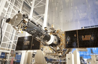
Informationen über den Satelliten. IRIS
| Name im Katalog Spacetrack | IRIS |
| Alternative Bezeichnung | INTERFACE REGION IMAGING SPECTROGRAPH |
| Folge IRIS | IRIS Tracker |
| Flugzeiten IRIS | Flugzeiten IRIS |
| In die Umlaufbahn bringen |
 2013-06-28 (13 vor Jahren)
|
| Tage im Orbit | 4808 |
| Herkunftsland/-organisation | USA (US) |
| Wir analysieren den polnischen Text, der 'Miejsce startu' lautet. | WRAS |
| Kategorie | |
| Perygeum | 614 km |
| Apogäum | 652 km |
| Neigung der Umlaufbahn (Inklination) | 97.93° |
| Runden pro Tag | 15 |
| Orbit | LEO (Sonnenbahn-synchron) |
| Höhe IRIS | 624.02 km |
Informationen über IRIS
The Interface Region Imaging Spectrograph (IRIS), also called Explorer 94, is a NASA solar observation satellite. The mission was funded through the Small Explorer program to investigate the physical conditions of the solar limb, particularly the chromosphere of the Sun. The spacecraft consists of a satellite bus and spectrometer built by the Lockheed Martin Solar and Astrophysics Laboratory (LMSAL), and a telescope provided by the Smithsonian Astrophysical Observatory. IRIS is operated by LMSAL and NASA's Ames Research Center.
The satellite's instrument is a high-frame-rate ultraviolet imaging spectrometer, providing one image per second at 0.3 arcsecond angular resolution and sub-?ngström spectral resolution.
NASA announced on 19 June 2009 that IRIS was selected from six Small Explorer mission candidates for further study, along with the Gravity and Extreme Magnetism (GEMS) space observatory.The spacecraft arrived at Vandenberg Air Force Base, California, on 16 April 2013 and was successfully launched on 27 June 2013 by a Pegasus-XL rocket.
Orbital Elemente
Durchschnittsgeschwindigkeit IRIS
Durchschnitt IRIS
Mittlere Rektaszension des aufsteigenden Knotens (RAAN) IRIS
Mittleres Argument des Perigäums IRIS
Mittlere große Halbachse der Umlaufbahn IRIS
Mittlere Bahnexzentrizität IRIS
Internationale Raumstation
Kauf uns einen Kaffee!

